Christmas Eve Forecast: Partly cloudy with highs in the middle to upper 60s. Temperatures will fall into the 50s by Christmas morning. As a strong upper level low pressure system pushes into north Texas a Pacific Frontal Boundary will be forced through Central Texas...as that boundary moves through the area early Christmas morning, there is a chance for showers and storms to develop along it. In fact, there is a risk for strong to severe thunderstorms (especially across east Texas) where the air will be a lot more unstable. Remember, unstable air promotes thunderstorm development. Honestly, I don't believe we are going to see much in the way of rainfall here across Central Texas.
Instability Map:


XMAS Day Hour by Hour Forecast:
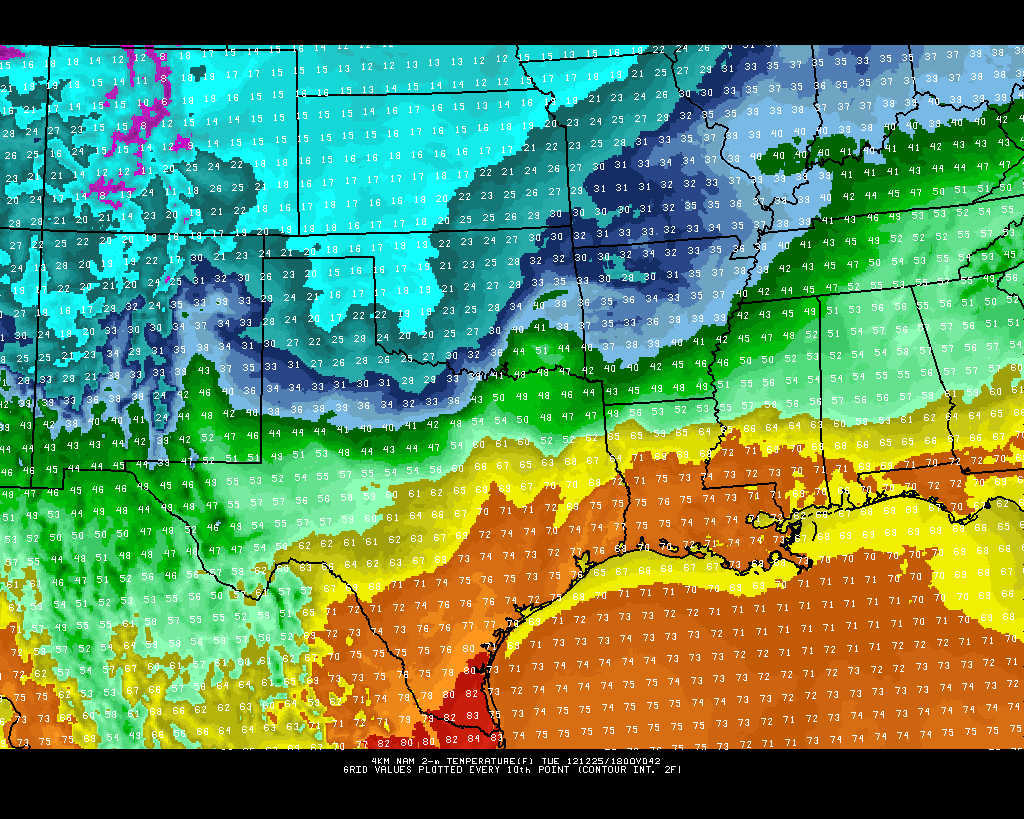
NAM MODEL:
NOON:

GFS MODEL:
3:00 PM:

7:00 AM WEDNESDAY MORNING:

*THE NAM MODEL IS A BIT FASTER WITH THE FRONT WHILE THE GFS IS A BIT SLOWER...NEVERTHELESS, THE FRONT WILL ARRIVE SOMETIME BETWEEN NOON-4 PM CHRISTMAS DAY WITH RAPIDLY FALLING TEMPERATURES AND GUSTY NORTHERLY WINDS...KEEP IN MIND TEMPS WILL BE IN THE 60S AND 70S ACROSS CENTRAL AND SOUTH TEXAS WHILE TEMPS WILL BE IN THE 10S AND 20S ACROSS THE PANHANDLE AND OKLAHOMA CHRISTMAS AFTERNOON WITH SNOW FALLING!
Snow will be falling across Oklahoma and extreme North Texas for much of Christmas Day. Temperatures will be in the 10s and 20s across Oklahoma on Christmas Day with gusty northerly winds creating blizzard conditions across Oklahoma for XMAS Day.
Latest high resolution snowfall models are indicating anywhere from 7-12 inches of snow across Oklahoma for Christmas Day...snow may fall as far south as the DFW Metroplex Christmas evening. However, accumulations will be on the light side with under 1 inch expected. Snow will stay well north of Central Texas.


No comments:
Post a Comment