Thursday, January 31, 2013

Are we done with winter? Not Yet!

Brief Weather Summary:

We officially started today at or below freezing across nearly all of central Texas; the mercury dropped to 32ºF at Camp Mabry this morning and 26ºF at the airport. As of 11 a.m. CST, temps have rebounded nicely into the upper 50s to lower 60s across the area thanks to abundant sunshine, very dry air, and a southwesterly surface wind. That southwest wind will pick up through the afternoon hours. Well, we can kiss the freezing temperatures goodbye for now, it looks like a stretch of spring-like weather is in store beginning tomorrow and lasting through Friday of next week. Highs will be rising back into the 70s over the coming days and stay there through the end of next week with overnight lows climbing back into the 40s and 50s.

Here's a look at my latest seven day forecast:


For all of you cold weather lovers, long range forecast models are indicating a strong Arctic Cold Front will sweep through Texas next weekend around the 10th of February. Long range forecast models are indicating that this front will be strong enough to take highs down into the 30s for central Texas with overnight lows plummeting well below freezing into the 10s and 20s. Keep in mind, this forecast is subject to change. Forecasting that far out is not a sure thing. Ahead of the front next weekend, temps look to soar into the 80s on a strong southwesterly wind.

Here's a look at the long-range GFS Temperature/Wind Model for Sunday, February 10th: Arctic Front will be pushing through the Texas Panhandle.


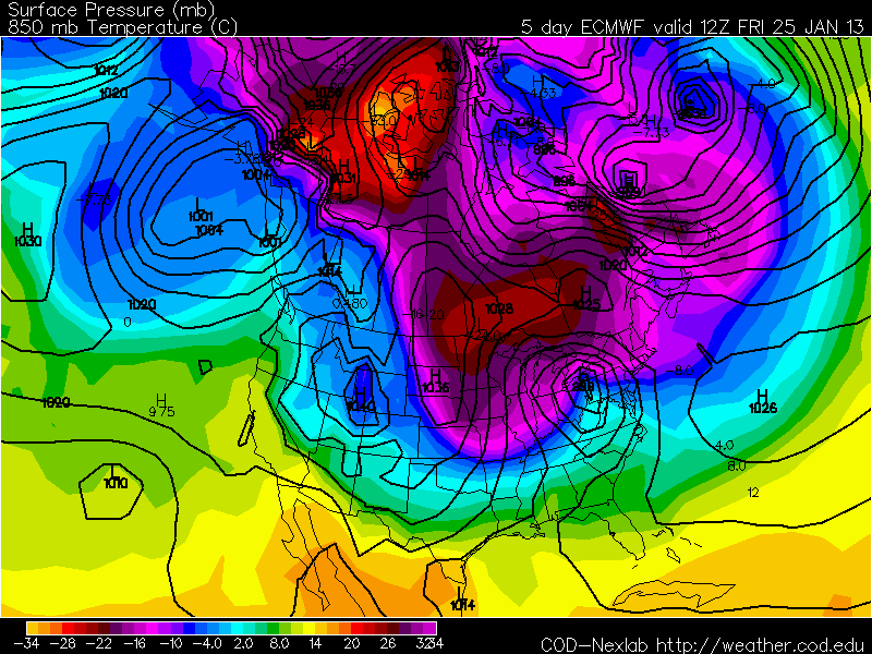
Upper level winds look very favorable for a blast of cold, Arctic Air to push into Texas. The forecasted 500mb map looks very similar to what it looked like during the big Arctic Blast back on January 31 through February 4, 2011


Long range forecast for 2/10/13 through 2/14/13 (Valentine's Day):


Sunday: Partly sunny, warm, and breezy with a high in the upper 70s to lower 80s; chance for late day showers and storms as the arctic front approaches

Monday: Front moves in early Monday dropping temps into the 30s on a gusty northerly wind by the afternoon; mostly cloudy

Tuesday: Area wide freeze in the 20s...highs only climb into the 30s; mostly cloudy

Wednesday: Frigid start in the 20s/30s gives way to some afternoon sun and temps in the 40s

Thursday: Cold start in the 30s gives way to a partly sunny and cool day in the 50s

***Please understand that this forecast is not set in stone; this is just an early prediction at what MAY happen, a lot can change between now and next weekend***


Tuesday, January 29, 2013

Record Warmth

The mercury officially soared to a record-shattering 85ºF this afternoon along the runways at Austin Bergstrom International Airport; beating the old record high of 82ºF set back on this date in 2006. The mercury soared to 84ºF along Mopac at Camp Mabry, missing their record high of 86ºF set back in 1917 by 2 degrees. The normal high for this time of year is 62ºF and the normal low for this time of year is 42ºF. We started the day off at 70ºF across a good portion of central Texas; some 28-33 degrees above average for this time of year. Our highs in the 80s this afternoon were a good 21-22 degrees above average.

Austin was not the only place in Texas that set brand new record highs. Here's a list of record highs set today from across the state of Texas:

San Antonio: 86ºF (Old Record was 84ºF set back in 1917)
Del Rio: 87ºF (Old Record was 82ºF set back in 1917)
Corpus Christi: 91ºF (Old Record was 86ºF set back in 2008)
*Laredo: 94ºF (Old Record was 90ºF set back in 1956)

What caused this record-breaking heat across central and south Texas? It is a weather phenomenon known as downsloping winds (compressional heating)...a west, southwest wind is notorious for bringing warm conditions to south Texas and central Texas. 

Let's take a look at ou regional geography. This is a shaded relief map of the state of Texas; I placed city labels on the map. The mountains across northeastern Mexico (the northernmost extent of the Sierra Madre Oriental Mountain Range) play a key role in our weather here in central Texas, when winds blow out of the west, southwest. As air is forced to flow down the mountains, it is compressed. As air is compressed, it heats up. Winds at 5,000 feet above sea level were blowing out of the west southwest ahead of the approaching cold front this afternoon. That west southwest wind aloft was blowing straight off of the warm and dry deserts of northern Mexico...this warm air mixes down to the surface and allows for temperatures to skyrocket across the area. This phenomenon occurs frequently during the late winter and spring months here in Texas as approaching weather systems and their associated fronts cause strong southwesterly winds to develop aloft over northern Mexico and Texas, which forces the air over the Mexican Plateau to sink and rapidly heat up. In turn, giving us well above normal temperatures. It is not uncommon for temperatures in Austin to be in the 80s, with temps in Laredo above 100ºF during March, April, and May.

Here is a graphic to help explain the situation:


This is a look at highs from across Texas today:


Highs across Central Texas: Check out how much hotter it was down in south Texas!


Windy front that blew through the area this evening will allow for a significantly colder start to the day across the state on Wednesday: Forecast lows on Wednesday morning


Forecast highs across the state on Wednesday: Gusty northerly winds and very dry air will allow for extremely high fire danger across the state


Sunday, January 27, 2013

Severe Weather Possible Tuesday

Hello everybody. I hope all of you are having a fantastic and relaxing weekend. Not knowing that it is the end of January, somebody might confuse today's weather with April. It is very spring-like out there today with very warm, humid, and windy conditions in place. We officially topped out at 81ºF this afternoon at Camp Mabry and 80ºF out at the airport. An approaching storm system and its associated cold front out west are allowing for the strong southerly winds across the area. Those winds are carrying plentiful amounts of Gulf of Mexico moisture into the state of Texas.

Sunday Morning:


Sunday Afternoon:


On Monday, look for a cloudy, dreary and humid start to the day with temperatures in the 60s area wide; areas of drizzle and light rain will be possible. Skies will turn partly sunny by afternoon, allowing for temps to soar into the upper 70s to lower 80s area wide. Believe it or not, Laredo may hit 90°F on Monday! Crazy! Isolated light rain showers will be possible through the afternoon hours.

Tuesday will start off just the same as Monday with low clouds and drizzle; Tuesday afternoon, skies will turn partly sunny, allowing for temps to climb into the upper 70s to lower 80s...keep in mind, winds will be quite gusty out of the south on Monday and Tuesday between 15-25 mph.

The Storm Prediction Center has placed north, east, and central Texas under the SLIGHT RISK category for severe weather...best chances for severe weather here in central Texas will be for areas along and east of the Interstate 35 corridor. YELLOW=SLIGHT RISK GREEN=General Storms 


Weather Set Up:

The polar jet stream will be taking a dip way south over the coming days...we call this a trough of low pressure (an elongated area of low pressure in the atmosphere) which is conducive to the development of showers and thunderstorms given the right ingredients.


As a surface low and its associated cold front move across the state on Tuesday afternoon/evening I'm expecting a line of strong thunderstorms to develop. Some of the storms will turn severe and be capable of producing large hail and damaging winds. Another factor to play close attention to, is that individual storms may develop out ahead of the main line. Those storms that develop ahead of the line may be capable of producing a tornado or two; especially across north and northeastern Texas.

Here's what models are forecasting. The latest high resolution NAM model is forecasting a strong line of storms to develop (stretching from north Texas down into central Texas) for Tuesday afternoon/evening:

Forecasted Temps 3 p.m. Tuesday afternoon: South Texas will be well into the 80s and lower 90s!! Very warm and unstable.


Forecasted radar 3 p.m. Tuesday afternoon: Line of storms beginning to develop west of central Texas


Forecasted radar 6 p.m. Tuesday evening: Strong line of storms just pushed east of the I-35 corridor


Forecasted radar 9 p.m. Tuesday evening: Strong line of storms pushing through east and southeast TX


How much rain are we talking? Generally, 0.30 inches or less across the Hill Country with 0.50 to 1 inch of rain possible for areas along and east of Interstate 35...the showers and storms will be moving quickly, therefore, they will not have time to drop significant rainfall.


More like a spring-time storm set-up than late January. Instability levels will be very high for this time of year; meaning, air will be rising at a very fast rate...remember, you need rising air for thunderstorms to develop. Higher CAPE (Convective Available Potential Energy) values indicate a greater risk for severe weather. Please be alert for rapidly changing weather conditions late Tuesday afternoon into early Tuesday evening.

Latest Seven Day Forecast: Cooler and drier conditions will move in behind the storms (Tuesday is highlighted in red, because we will be under the risk for severe weather)


Friday, January 25, 2013

Weekend Update: Spring in January

Good evening everybody. Well, we hit 81°F for the second day in a row here in Austin, yesterday's high of 81°F tied the record high set back in 1971. Keep in mind, the normal high for this time of year is in the lower 60s. Our low this morning of 62°F is more in line with where high temperatures should be for this time of year. We are running some 20 degrees above normal for both highs and lows for this time of year. North Texas was in the upper 40s this afternoon and south Texas soared well into the 80s. Cold front has stalled out just south of Waco.

5 p.m. temperatures across the state:


That cool front will slide through central Texas overnight, allowing for winds to turn northerly for a while before quickly returning to southerly for Saturday afternoon. The northerly breezes tonight will allow for temps to dip into the 50s...quick return to southerly winds will keep highs in the 70s this weekend. While it is going to be a warm weekend, it is not going to be a bright weekend. Clouds will fill in late tonight and stick around through early next week. Don't be surprised to see some drizzle and fog across the area over the weekend. Temps will soar to near 80°F again for Monday and Tuesday ahead of a fast-moving storm system that will introduce a slight chance for showers and thunderstorms across the area on Tuesday. Behind this disturbance, our next cold front will arrive and take highs and lows back down to normal for this time of year for the middle to end of next week with highs in the 60s and lows in the 30s and 40s.

Forecast models are forecasting a big dip in the jet stream on Tuesday of next, that will bring us a shot at some rain on Tuesday as well as a cool down for the middle and end of next week. Unfortunately, we will be on the southern edge of this disturbance, therefore, rain chances will be slim. 


An isolated strong storm cannot be ruled out on Tuesday as instability will be quite high over central and east Texas. The only problem is, the atmosphere may be capped, meaning, a layer of warm, dry air in the upper levels of the atmosphere may inhibit thunderstorm development. Remember, storms like air to cool with height, however, if a storm can break through that cap in the atmosphere, it could become severe quickly with damaging wind and hail. 


We will definitely have plenty of moisture at the surface and aloft for thunderstorms to develop.


Long range forecast models are not indicating any Arctic Air for Texas over the next week and beyond.  

Monday, January 21, 2013

BIG Arctic Blast for Midwest and Northeast!

As of writing this blog, the current temperature in Minneapolis is -7°F with a wind chill temperature (what it feels like to bare skin) of -28°F!!! The current temperature in Chicago is 10°F with a wind chill of -8°F...that big push of Arctic Air is on its way to the northeast. Temps will plummet into the negative teens tonight in Minneapolis with temps falling into the -5 to 0°F range in Chicago!

*MAKE SURE TO CLICK THE IMAGES TO MAKE THEM BIGGER*

This is a look at current temperatures across the nation:

This is a look at current temperatures across north America: (You can clearly see the source of the brutally COLD Arctic Air) Believe it or not, this Arctic Air is actually Siberian in nature...sometimes nicknamed a Siberian Express, upper level winds pull this cold air over the north pole and into the U.S.


A large ridge of high pressure across the western United States is keeping that frigid, Arctic Air across the eastern third of the United States; If that ridge of high pressure was centered over the Pacific Ocean, that frigid air would have had a better chance at making it here to Texas. Forecast models are not showing any major cold blasts heading to Texas over the next week, however, a nice cool down looks to be in store for Friday and this weekend.

Minneapolis's latest weather forecast:

 Chicago's latest weather forecast:


New York's latest weather forecast:


Washington D.C.'s latest weather forecast:


For all of you cold weather lovers (including myself), long range models are hinting at another large push of Arctic Air to head south and cross the Canadian Border towards the middle/end of next week...upper level wind patterns would be more favorable for this batch of frigid air to make it to Central Texas. Keep in mind this is an EARLY PREDICTION of what MAY happen.

Forecasted surface temperatures for 6 a.m. Thursday, January 31st:


 Forecasted upper level wind conditions for 6 a.m. Thursday, January 31st:


Sunday, January 20, 2013

Mild, then Warm, then Cool!

Good evening everybody. I hope you are all having a wonderful weekend. First things first, we topped out at 75ºF this afternoon at Camp Mabry; 13 degrees above normal for this time of year. Tonight, look for increasing clouds with patchy areas of fog developing late tonight...lows will fall into the middle to upper 40s. A weak cold front will blow through the area during the day tomorrow, allowing for winds to turn to the northeast and for temperatures and humidity levels to drop slightly. Highs will climb into the 60s area wide with lows falling into the 40s Monday night. Temps will remain in the 60s for highs on Tuesday under a mostly cloudy sky. Highs will rebound to near 70ºF for Wednesday with highs soaring well into the 70s on Thursday thanks to a breezy southwesterly wind between 15-25 mph. The warm air advection and down sloping winds off of the mountains of northern Mexico will ensure a warm day here in Central Texas. The record high on Thursday is 81ºF set back in 1971; we will get very close! Strong cold front blows through the area late Thursday night into Friday morning dropping highs back into the 50s with lows back into the 30s for Friday through the weekend. Unfortunately, rain is not in the forecast for the upcoming week; long range forecast models are indicating some rain may enter the forecast by the 29th. We will keep our fingers crossed.

Sunday's High Temperatures from across central Texas:


Near Record Warmth on Thursday: GFS MODEL


Colder for Friday into next weekend: ECMWF MODEL


GFS HIGH RESOLUTION MODEL (freeze possible Saturday night):


If you have any questions please do not hesitate to ask!


Tuesday, January 15, 2013

Arctic Blast Possible Next Week!!!

Hope you all are not tired of the cold weather! Long range forecast models have persistently been forecasting a major Arctic Air outbreak for the Midwest and eastern United States for next week! Minneapolis may not get above 0°F for highs early next week with lows in the -10s (negative teens) possible. Chicago's highs will drop into the single digits and lower 10s with overnight lows dropping to -5 to 1°F!!! Keep in mind, those numbers are not including wind chills that may drop as low as 30 degrees below zero across extreme northern portions of the U.S.

So, what does this mean for Texas? To be quite honest, I'm not very positive on next week's forecast. Two of the main forecast models that I look at, the GFS (American Model) and the ECMWF (European Model) are forecasting two different scenarios for Texas. Both of the models bring a cold front through Central Texas on Monday of next week; the difference is that the ECMWF model wants to bring a blast of Arctic Air into Texas while the GFS wants to bring just some normal cold weather (not Arctic in nature). Forecast models tend to struggle with Arctic Air, many times showing the bulk of it missing Texas to the east while in reality the cold air pours into Texas as well. This possible Arctic front for early next week could have the potential to take highs down into the 30s with overnight lows dropping into 20s.

ECMWF Model Snapshot for Monday, January 21, 2013: (Check out that blob of frigid air covering much of the northern U.S.) Reds and purples indicate temperatures well below zero)


ECMWF Model Snapshot for Tuesday, January 22, 2013 (Shows the bulk of the really cold air pushing east, however, the blues over Texas still indicate temps near freezing, if not below)


Another KEY ingredient in forecasting an arctic air outbreak is upper level wind patterns. A strong ridge of high pressure will develop across the western U.S. over the coming days. If the high is farther west, we have a better chance to see the arctic air to pour into Texas. If the high is farther east, it will push the arctic air farther east.

GFS 500mb map valid Tuesday, January 22, 2013:


If you have friends/family in the northern plains or the eastern United States, make sure to reach out and let them know that some BIG changes are coming! 


Monday, January 14, 2013

Arctic Air Invasion!

Let's start with a look at current temperatures across the lower 48 right now! Arctic Air continues to pour into the United States on brisk northerly winds...we can thank a big dip in the jet stream for the cold blast. Los Angeles, CA saw their coldest temperature in 22 years this morning when the mercury dropped to 34ºF. 


A strong ridge of high pressure off of the west coast of the United States is pulling the cold air out of Canada into the western and central United States. With this pattern locked in place over the next several days, we will continue to see cold air pour into Texas on gusty northerly breezes. As the upper level low approaches the area from the west over the coming days, our skies here in central Texas will cloud up. Thanks to some sunshine today, our temperature was able to climb to 51ºF here in Austin. With more clouds for tomorrow and Wednesday, I'm only expecting highs to make it into the middle 40s with with wind chills in the 30s thanks to breezy northerly winds. As that disturbance approaches from the west, there is a SLIGHT chance for a few sleet showers or possibly a couple of snow flurries across central Texas Tuesday night into early Wednesday. No accumulation is expected.

Southwesterly winds in the upper levels of the atmosphere are allowing for Pacific moisture to stream across Mexico and into the state of Texas. That's what was giving us the cloudy periods during the day today and right now. Latest satellite imagery shows all of central and south Texas blanketed by a layer of mid to high level clouds. Those clouds made for a beautiful sunset this evening. 


(Image Above) This is a look at the current upper level wind pattern and temperature map at 18,000 feet aloft. Big dip in the jet stream is clearly visible across the western and central U.S. The jet stream is dipping all the way south into northern Mexico. This system will continue to slowly push east over the coming days. We will start warming things up by Thursday with highs returning into the 50s; 60s possible for the weekend before another cold front ushers in some more chilly air for the beginning of next week. Over the weekend, long range forecast models were indicating the possibility of a powerful Arctic Blast for much of the central and eastern U.S. for next week. Latest models indicate the coldest air should stay east of Texas. I'm watching each model run closely. If that air mass breaks loose and heads our way, highs will drop into the 30s with overnight lows in the 10s and low 20s for Central Texas. *AS OF RIGHT NOW, MODELS HAVE BACKED OFF ON THE POSSIBILITY OF THIS HAPPENING, HOWEVER, IT STILL BEARS WATCHING*

Friday, January 11, 2013

BIG Front hits tomorrow!

Good evening everybody. We officially topped out at 75°F today at Camp Mabry; some 14 degrees above normal for this time of year. Frigid, Arctic Air, is covering a good portion of the western United States right now. Temperatures are in the single digits across Montana with temperatures below zero across southern Canada. The leading edge of this cold air will move through Central Texas between 4-7 p.m. tomorrow evening. Ahead of the front, it is going to be a cloudy and muggy day with temps in the 60s and 70s; scattered rain showers will be possible through the day. Showers may organize a bit more with the frontal passage and turn into thunderstorms east of the Interstate. The Storm Prediction Center has placed east Texas under the SLIGHT RISK CATEGORY for severe storms.

Western Australia Sandstorm

I'm sure most of you have heard about the crazy sandstorm that affected portions of Western Australia on Wednesday evening. The sandstorm is known as a Haboob, meaning blasting/drafting in Arabic. You may have seen similar scenes in the south western portions of the United States during the Monsoon season. No doubt, most of you have seen the incredible images of the massive sandstorm that hit Phoenix, Arizona this past summer. 


What causes these massive sandstorms?

In particular, let's focus on the recent Western Australia Sandstorm. Below are the photos of the massive sandstorm that struck portions of western Australia.


First, let's take a look at the general landscape of Australia. Deserts make up 44% of the continent of Australia; another 37% of Australia is made up of semi-arid conditons and grasslands. Add both those numbers up and nearly 81% of Australia is made up of desert/semi-arid conditions. Deserts are classified as an area that receives less than 10 inches of rain a year.  Check out all of the red sand across Australia (clearly visible on high resolution satellite imagery). The area circled in yellow is where the dust storm occurred.


Several factors came together this past Wednesday in Australia to lead to the incredible show that Mother Nature put on. First, Australia has been dealing with one of their worst, if not the worst, heatwave on record. Remember, it is summer in the southern hemisphere right now. This past Monday, Australia sweltered through its hottest day on record with a nationwide average temperature of 104.5°F (40.3°C), breaking the previous record of 104.3°F set back in 1972. Four of Australia's hottest 10 days have just been recorded this year! Believe it or not, the Australian Weather Bureau had to add new colors to their temperature maps to accomodate the insanely high temperatures that baked central portions of Australia. Temps exceeded 122°F in central Australia earlier this week. Purple blob in the center of Australia forecasted temperatures above 122°F (50°C) across central Australia earlier this week. Incredible!


Extremely dry conditions, gusty winds, and extreme heat have allowed for numerous wildfires to burn out of control across Tasmania and southeastern Australia...Sydney, Australia (located along the southeastern coastline of Australia) is expected to hit 102°F later this afternoon before a big cool down arrives tomorrow and lasts through the majority of next week.  The average high for Sydney in January is 78°F.


Sydney, Australia Skyline:


Australia has got a lot going on right now in the weather department. Heatwaves, fires, winds, and tropical cyclones!

Just to the north and west of the area that experienced the large sandstorm on Wednesday is Tropical Cyclone Norelle with sustained winds of 125 mph (Category 3 Hurricane Strength)...hurricanes in the northern hemisphere spin counter-clockwise, however, in the southern hemisphere, they spin clockwise.


 The clockwise flow around Norelle and the counter-clockwise flow around the massive dome of high pressure sitting on top of central Australia, allowed for a east northeasterly surface wind flow to develop across western Australia, as that hot, dry air moved from inland Australia towards the coast, it runs into some mountain ranges, the air is forced to rise as it hits the higher elevations producing a weather setup known as orographic lift. The orographic lift combined with the intensely hot temperatures (which produce enough lift by themselves) forced showers and thunderstorms to develop east of the coastline...as these storms died, they sent out a rush of cold air, a downdraft. Since cold air is much denser than warm air, it rapidly falls from the base of the thunderstorm towards the desert floor. Once the cold air hits the desert floor and mixes with the warm air, the battle is on between hot and cold. Therefore, strong, gusty winds develop. Those wind gusts, which exceeded 60 mph, picked up the dust and sand across the desert floor, in turn creating a massive sandstorm. The rush of cool air out of the dying storms is known as an outflow boundary, a mini cool front. Outflow boundaries are very typical here in central Texas during the summer months with short-lived showers and storms during summer afternoons. Because, we do not live in a desert, there is no sand to be picked up.


 Tropical Cyclone Norelle will remain off the coast of western Australia, however, folks along the western coast of Australia will experience gusty winds and torrential tropical downpours. Another tropical cyclone looks to affect northwestern Australia by the middle to end of next week. 

500mb weather maps clearly show the massive ridge of high pressure over Australia and Norelle! Norelle is located in the left-hand side, circular area of red and yellow. Upper level winds around the high will keep Norelle off of the coast and swing it south of Australia by next week.