FRIDAY AFTERNOON UPDATE:
TORNADO WATCH remains in
effect until 7 p.m. CDT for Williamson, Travis, Bastrop, Lee, Caldwell,
Fayette, and Milam counties. The tornado threat is rather low, however, it is
not zero. Any tornadoes that do develop would tend to be weaker, more
tropical-type tornadoes. Nevertheless, a tornado is a tornado and can produce damage
to life/property.
FLASH FLOOD WATCH
remains
in effect for ALL of south central Texas through 10 a.m. CDT Saturday
(Halloween) morning.
FLASH FLOOD
WARNING remains in effect until 7:15 p.m. CDT Friday evening for the
following locations:
1) Northwestern
Bastrop County
2) Williamson
County
3) Travis
County
4) Northeastern
Guadalupe County
5) Western
Caldwell County
6) Central
Hays County
***ADDITIONAL RAINFALL AMOUNTS OF ONE INCH ARE POSSIBLE IN THE
WARNED AREA…RUNOFF FROM EARLIER HEAVY RAINS IS STILL CAUSING ISSUES ACROSS
THESE AREAS***
REMEMBER, IF YOU COME ACROSS A FLOODED ROADWAY, TURN AROUND, DON’T
DROWN!!!
FORECAST
DISCUSSION:
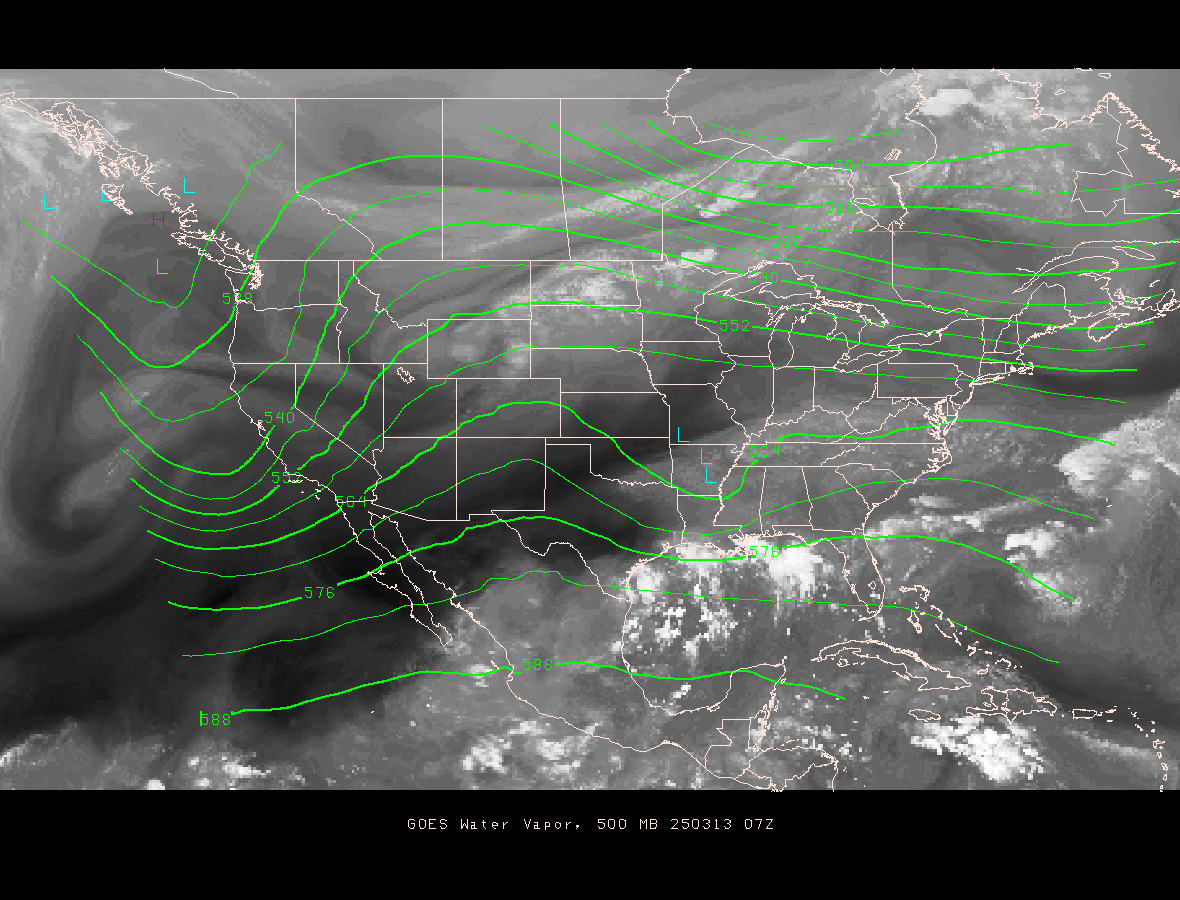
The potent upper level Pacific storm system is still located
well west of south central Texas and is currently centered as of the latest
water vapor satellite imagery over southern New Mexico. Until this upper level
low pressure system crosses the area, upper air disturbances, or ripples in the
atmosphere will continue to move across the area. Each ripple will bring a
round of showers and storms. According to the latest high resolution forecast
models, a second round of heavy rainfall and strong thunderstorms will be
possible later this evening (after 10 p.m. CDT) for Austin, with a third wave
of showers and storms moving in closer to daybreak Saturday with the arrival of
a Pacific cold front. With this in mind, the flooding threat will remain with
us as we head into the evening, overnight, and early morning hours of Saturday.
Areas south of Austin have seen widespread rainfall amounts on the order of
8-14 inches of rainfall. It will not take much additional rainfall to aggravate
our already delicate flash flooding situation. Showers and storms look to exit
the area to the east by midday Saturday as a much drier and more stable
atmosphere moves into the area behind Saturday morning’s frontal passage. I’m
still holding out that the majority of Saturday will be nice with beautiful
fall weather moving into south central Texas on Sunday with highs in the 70s
and lows in the 50s under sunny/clear skies.
FORECAST
RADAR IMAGERY 9 P.M. CDT FRIDAY EVENING (this particular model is showing
a line of strong storms moving through the western hill country and approaching
the I-35 corridor)

FORECAST
RADAR IMAGERY 5 A.M. CDT SATURDAY MORNING (this particular model is
showing a third line, hopefully the last, moving through the I-35 corridor
before sunrise as that much-anticipated cold front crosses the area…clearing
conditions expected behind the front)

Additional rainfall amounts could exceed 2-4 inches across the
area with some locations possibly receiving more…of course any additional rain
will add insult to injury.
In addition to the risk of additional flash flooding, strong
gusty winds, dangerous cloud to ground lightning, and isolated tornadoes will
all be possible.
LET’S CONTINUE TO REMAIN WEATHER AWARE OVER THE NEXT 12-24 HOURS
HERE ACROSS SOUTH CENTRAL TEXAS…PLEASE STAY TUNED TO LOCAL MEDIA OUTLETS AND
THE NATIONAL WEATHER SERVICE FOR THE VERY LATEST AND MOST UP TO DATE FORECAST
INFORMATION.
No comments:
Post a Comment