Forecast Discussion
As of the latest
drought monitor update released today, moderate drought has returned to central
Texas along with a large area of abnormally dry conditions. It has been over 40
days since we received our last measurable rainfall here in Austin back in
early January.
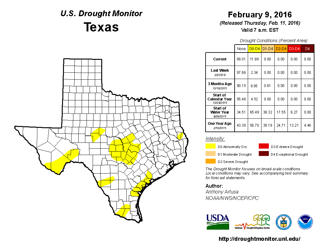
Latest Drought Monitor Update (released
02-18-16)...click images to make larger


Last Week’s Drought Monitor Update
(released 02-11-16)

Dry, windy, and
well above average warmth across the region has led to an increased risk of
wildfires. Thankfully long range models have continued to indicate the
potential for some much needed relief heading our way by the end of the weekend
into early next week.
Rain Possible late Sunday into Monday
An upper air disturbance and a cold front will work together to lift the moisture over central Texas late Sunday into Monday. The upper level lift provided by the upper air disturbance and the surface lift provided by the cold front will bring us the best chance of rain we have seen in a long time. Latest long range forecast model guidance indicating we could see 0.25 to 0.75 inches of rain across the area. Of course those numbers will be changing over the coming days as models get a better grip on the forecast. Cooler air looks to move into the area behind Monday’s cold front setting us up for a much cooler stretch (60s/40s) of weather next week compared to the 70s and 80s we have been experiencing for quite some time now. We will keep our fingers crossed for some rain.
GFS Forecast Rainfall Accumulation (valid now through noon Tuesday)...remember, this is just a model and reflects how much rain we may see late Sunday into Monday...forecast rainfall accumulation will likely change as we get closer to the actual weather event:

Image above courtesy of Pivotal Weather
No comments:
Post a Comment