Forecast Discussion || Cold Front Arrives Tonight
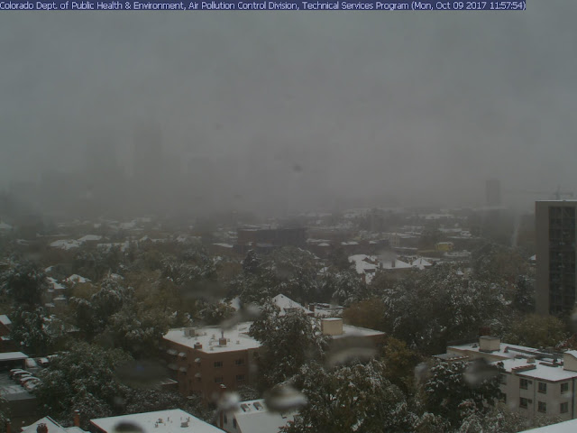
Our first significant cold front of the 2017 fall season arrives late tonight into early Tuesday morning. Latest indications are that the front will arrive between midnight to 3 a.m. CDT. There is a 30-40% chance for scattered showers and/or brief thunderstorms as the cold front pushes through the area generating lift (rising air). Behind the frontal boundary, a significantly cooler and drier air mass will invade the area from the north on breezy/gusty north winds. Winds will gust between 25-30 mph well into Tuesday morning. This same storm system is producing snow across Colorado today. Denver is currently a winter wonderland with between 4-6 inches of snowfall accumulation already being reported and it's still snowing. This is Denver's earliest reported snowfall in the past 5 years.
Denver Web Cam Shot taken at 1:00 p.m. CDT today (12:00 p.m. MDT):
Where is the front?
As of 1 p.m. CDT, the leading edge of the cold front is currently pushing through northwest Texas, just now reaching portions of the I-20 corridor. It's 55°F in Amarillo and 92° in Dallas.
Current Temperatures across the nation as of 1:00 p.m. CDT
How much cooler?
Highs on Tuesday should only manage the 70s after starting the day in the 50s and 60s area wide. Lows Tuesday night into early Wednesday morning will dip into the 50s area wide with typically cooler locations dipping into the 40s. Highs on Wednesday should only manage the 70s to near 80 before the above normal temperatures return for the end of the week and the upcoming weekend. The average high/low for this time of year in Austin is 84/63.


No comments:
Post a Comment