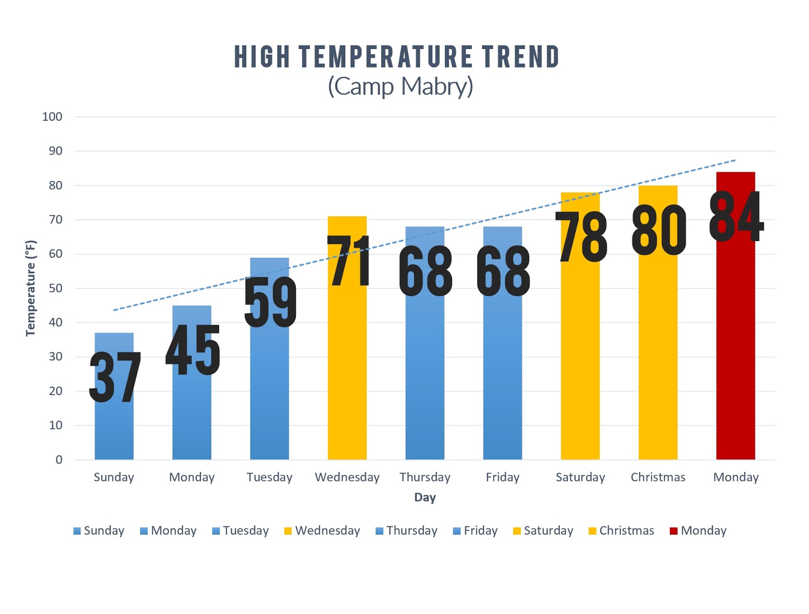
It goes without saying that it has been an unusually warm past several days across the area. Highs climbed into the upper 70s Christmas Eve, 80°F on Christmas Day, and a record-shattering 84°F yesterday. Check out the high temperature trend chart below. It's hard to believe a week ago we were coming off the heels of an Arctic Blast. That's winter in Texas for you!
Fog, Drizzle Possible Tonight
Despite the passage of a weak "cold" front early this morning, temperatures have still managed to climb into the 70s area wide. The front is washing out to our south and will return north as a warm front tonight, allowing moist southerly flow to return to the area. Widespread clouds, fog, and drizzle likely late tonight into Wednesday morning with mild overnight lows in the 60s. Some areas of dense fog may develop.
Thursday Cold Front
A stronger cold front is set to move through the region early Thursday morning, bringing with it gusty north winds and COOLER temperatures in its wake. Highs on Thursday behind the front should only manage the upper 50s in the coolest locations (northern/western zones) and low to mid 60s in the warmest locations (central/southern/eastern zones). Wind gusts of 25-35 mph will likely stir up the cedar pollen across the area resulting in a bad day for allergy sufferers. Temperatures drop into the 30s/40s Thursday night into Friday morning under a partly clear sky...freezing temperatures are NOT expected. Other than some drizzle or very light rain, the front is expected to move through the area without rain.
No comments:
Post a Comment