Forecast Discussion:
Good Wednesday afternoon folks! We've made it to the middle of the week, and the big Labor Day Weekend is nearly upon us. It's mainly just going to be hot for us here in central Texas, but we cannot rule out some scattered afternoon and evening showers and thundershowers across the area. The big weather story over the coming days is going to be the newly formed Tropical Storm Hermine in the Gulf of Mexico with current sustained winds of 40 mph gusting to 50 mph. Hermine is NOT going to be affecting Texas as she has her eyes set on the gulf coast of Florida right now and eventually the Atlantic Seaboard.
The very latest public advisories from the National Hurricane Center concerning Tropical Storm Hermine can be found HERE.
Latest Forecast Track for Tropical Storm Hermine:

Areas shaded in BLUE/PINK along the Florida Gulf Coast are under a TROPICAL STORM WARNING and a HURRICANE WATCH...Hermine has the potential to strengthen into a minimal category one hurricane before making landfall.
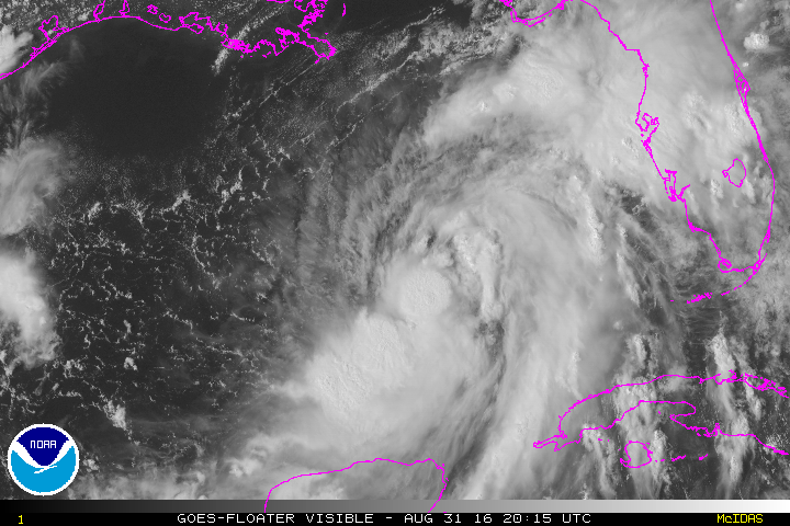
Here's a look at the latest visible satellite image of Hermine courtesy of NASA:
Central Texas Temps through Labor Day:
Highs will remain in the low to mid 90s through the upcoming Labor Day Weekend with overnight lows remaining warm in the 70s. Afternoon heat indices, thanks to high humidity, will remain very close to the century mark.
No comments:
Post a Comment