FORECAST DISCUSSION:
TGIF Everybody! Cold front that blew through here Wednesday evening has
really ushered in some nice, cool Canadian Air into the region that will be
sticking around with us through the weekend. Temperatures are in the 60s area
wide. Lots of Pacific mid and high level moisture overrunning the cool air mass
in place over our area as evidenced by the mostly cloudy to overcast conditions
across the area. That mid to high level moisture is streaming over the area in
advance of our next upper level storm system that will be shaking things up
once again for us over the coming days. Especially as we head into
Monday/Tuesday of next week as a strong surface cold front and the best upper level
dynamics move across the state of Texas.
Weekend Outlook:
As upper air disturbances, or ripples, in the upper level west
southwesterly wind flow (subtropical jet stream) cross the area over the
weekend, showers and thundershowers will be possible across the area beginning
as early as tomorrow (Saturday) in advance of this dynamic upper level Pacific
storm system. Light northeast wind flow at the surface will keep the cool air
mass over us now in place through Sunday…that will ensure a cloudy, cool, and at
times wet weekend across south central Texas. The activity that develops
tomorrow and Sunday will NOT be severe, however, some moderate downpours and
some cloud to ground lightning cannot be ruled out. Highs this weekend likely
to remain chilly in the upper 50s to lower 60s across the area with lows
generally in the 50s. It will be a good idea to keep the rain jacket and umbrella handy.
Heavy Rainfall/Severe Weather Setup:
Southerly winds return to the area early Monday allowing Gulf of Mexico
moisture to flood back into the area ahead of the main dynamics and cold front
with our next approaching storm system. Given the dynamic nature of this next
system, heavy rainfall and severe weather will both be a threat Monday and
Tuesday of next week. Storms that develop late Monday into Tuesday will have
the potential to become strong and/or severe with large hail, damaging winds,
and isolated tornadoes. Of course, I will be watching the evolution of this
system closely. As of right now, it looks like scattered showers and
thundershowers will be possible during the day on Monday with the heaviest
activity arriving late Monday into early Tuesday as the cold front crosses the
area. It looks like a line of heavy showers and storms will develop along and
immediately ahead of the front. If some stronger storms are able to develop out
ahead of this forecast line of storms, those isolated storm cells will be the
ones we need to watch closely for possibly producing a tornado or two. The
biggest threats with a line of storms tends to be strong, gusty winds and small
to medium sized hail. Of course, deadly cloud to ground lightning and heavy
rainfall will be a threat from any storm that develops.
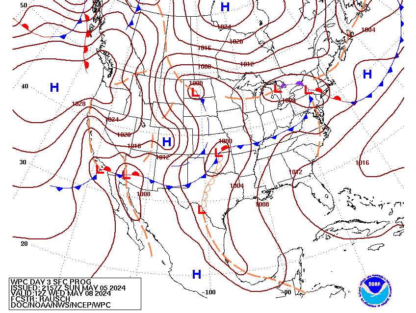
Forecast Model (Precipitation and sea level pressure) Map for early Tuesday...this particular model shows a line of heavy showers and storms moving across central and east Texas...pretty advanced map, but it does a good job of portraying what the situation may in fact look like on Tuesday morning
Severe Weather Risk Areas:
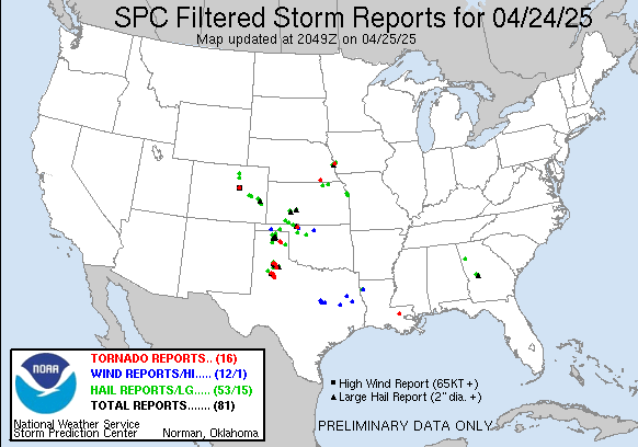
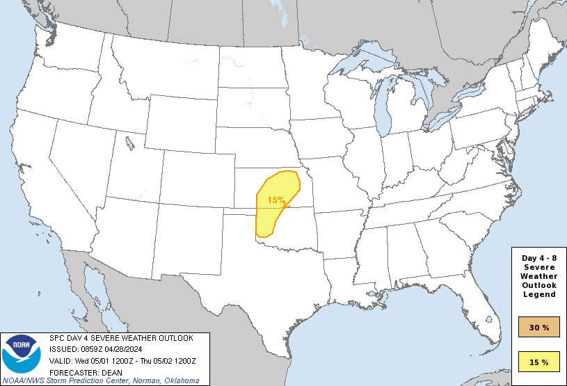
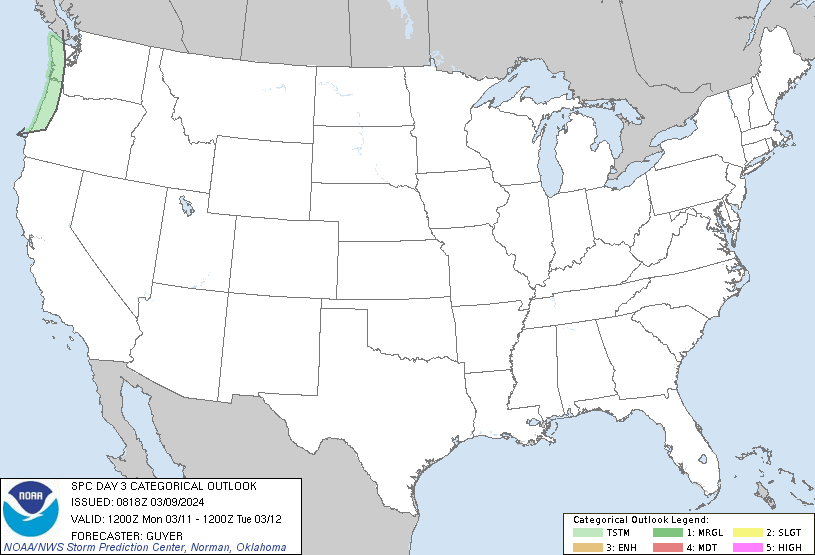
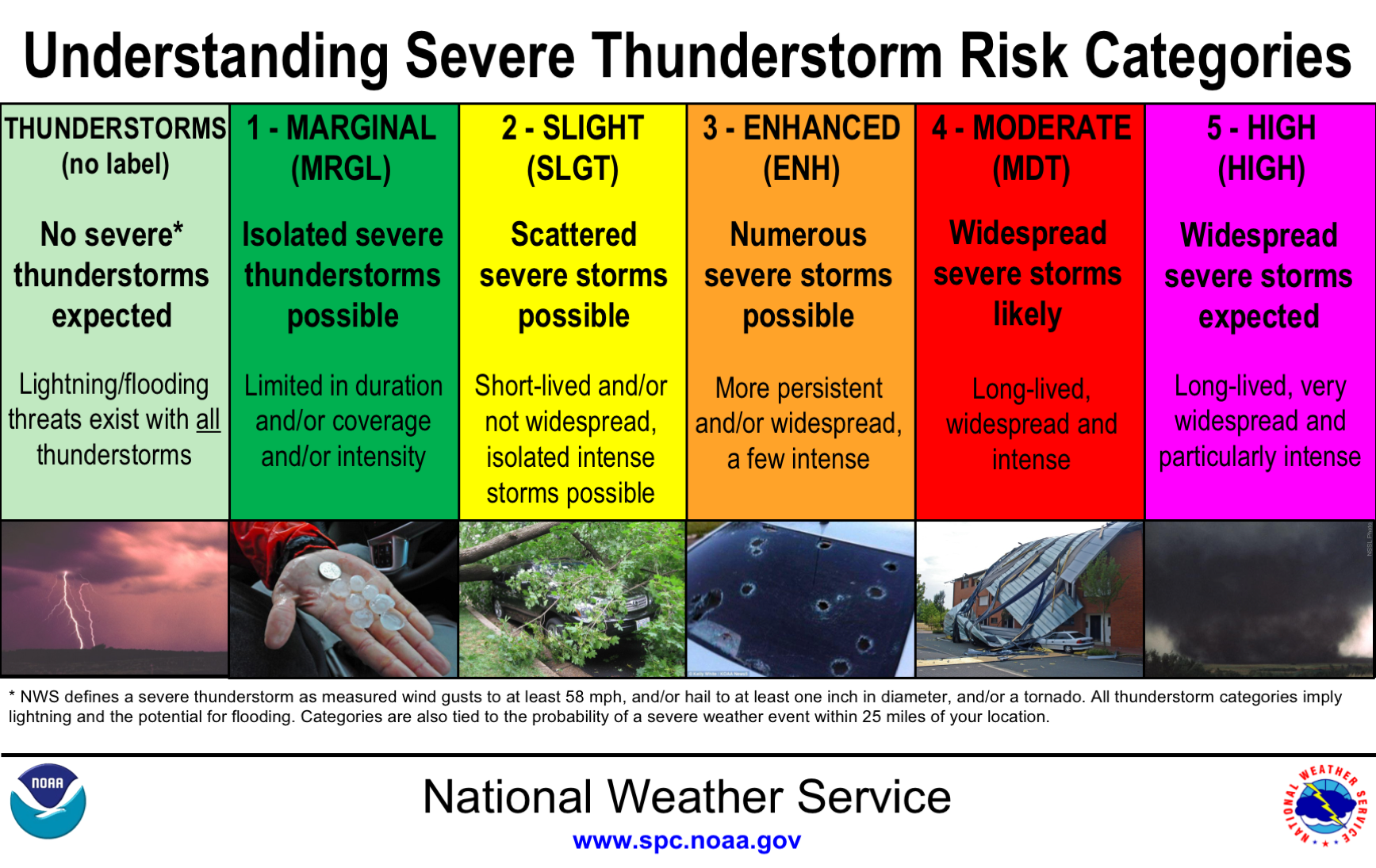
The Storm Prediction has included south central Texas in the risk area
for potential severe weather Monday/Tuesday of next week. We will be getting
better details on this in the coming days. You can keep up with the latest
severe weather outlooks created by the Storm Prediction Center by clicking
HERE. The Storm Prediction Center really does a great job highlighting
potential severe weather events days in advance and plays an integral role in
keeping us safe on a daily basis.
Monday Severe Weather Risk (Yellow-shaded area)
Tuesday Severe Weather Risk (Yellow-shaded area)
Windy & Cooler Behind the Front
Behind the system, late Tuesday morning into early Tuesday afternoon a
strong cold front looks to push into the area from the northwest and usher in
some of the chilliest air we have so far this fall. This cold front will be
preceded by a line of strong, potentially severe storms. Gusty northwest winds
will usher in a much drier and cooler air mass into central Texas. This will
set us up for cool afternoons in the 60s for the middle to end of next week
with overnight lows dipping into the 40s area wide. Thursday morning is shaping
up to be a chilly one with lows in the 30s possible across low-lying and
out-lying areas of central Texas. Freezing temperatures should NOT be an issue
with this particular front.
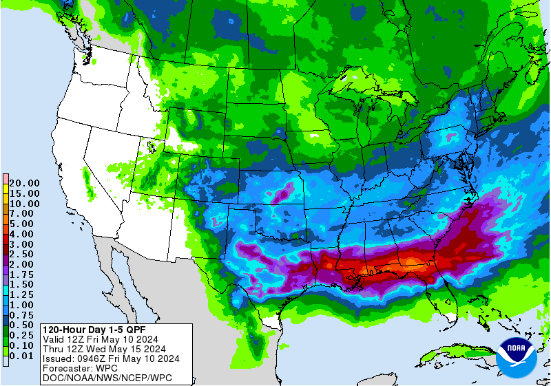
How much rain are we going to see?
It is difficult to pinpoint just how much rain this system is going to
produce, however, it looks as we could be looking at a widespread 1-3 inches of
rain across the area, with heaviest totals looking to come along and east of
the IH-35 corridor, especially for areas north and east of south central Texas
as evidenced in the Weather Prediction Center’s latest 5 day forecast rainfall
accumulation map.
W.P.C. 5 Day Forecast Rainfall Accumulation:
We still have several days to watch the evolution of this system…remember,
this is just a forecast and is subject to change and is likely to change
slightly over the coming days. As always, please remember to heed all
watches/warnings/advisories issued by the National Weather Service, Storm
Prediction Center, etc.…
LET'S KEEP THOSE UMBRELLAS, RAIN BOOTS, AND RAIN JACKETS HANDY!
ON A GOOD NOTE, RECENT RECORD RAINFALL HAS PUT AN END TO THE AGRICULTURAL DROUGHT ACROSS SOUTH CENTRAL TEXAS...IT'S NICE TO SEE SO MUCH WHITE (A.K.A. DROUGHT-FREE) AREAS ON THIS MAP.
YELLOW AREAS = ABNORMALLY DRY
BEIGE AREA = MODERATE DROUGHT


