Forecast Discussion:
…shower/thunderstorm chances increasing…
…severe thunderstorms possible Sunday
afternoon/evening across central Texas…
Storm
Prediction Center Severe Weather Outlook (valid 6 a.m. Sunday morning through 6 a.m.
Monday Morning)

A dynamic upper level storm system, currently located over northwestern
Mexico (south of Arizona), and an eastward moving Pacific Cold Front at the
surface combined with Gulf of Mexico moisture will lead to increasing chances
for showers and thunderstorms across the region Sunday/Sunday evening. Some of
the storms that develop (especially along and west of the I-35 corridor) have
the potential to become strong and/or severe with damaging winds, hail, and an
isolated tornado being the primary threats. Heavy rainfall and deadly cloud to
ground lightning will accompany the storms. Rainfall accumulation between 0.50 to 3.00 inches possible across the area.
The wedge of shallow, cold air over us now will be forced to
retreat north of the area by early Sunday afternoon thanks to the development
of a stronger southerly surface wind developing in response to the approaching
storm system. How far north this wedge of cool air goes is going to play a
major role in determining if we will be seeing thunderstorms across the area
late Sunday morning/early afternoon or rain showers. Latest forecast model
guidance indicates the potential for two rounds of showers and storms across
the area. The first coming late Sunday morning into early Sunday afternoon and
another late Sunday afternoon/Sunday evening into the late evening hours. It
looks like the second round of storms will be the one to really keep our eyes
on for potential severe weather. There is the potential for a line of showers
and storms (some potentially strong and/or severe) to approach the I-35
corridor from the west Sunday evening.
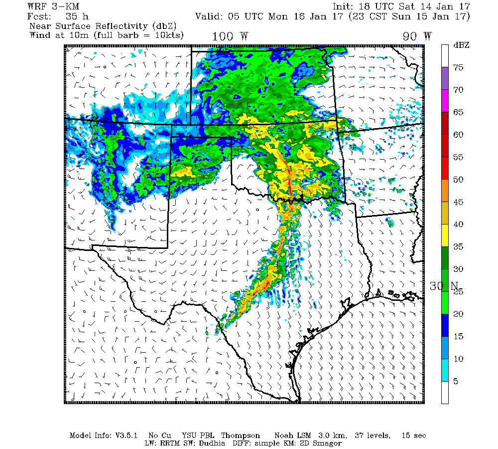
Forecast Radar (11 p.m. CST) TX Tech WRF Hi-Res Model
Severe
Thunderstorm Definition:
Per the
National Weather Service, a severe thunderstorm is a thunderstorm that produces one inch hail or
larger in diameter and/or winds equal or exceed 58 miles an hour and/or a
tornado.
No comments:
Post a Comment